MAOUDC: The Underground Temple Beneath Kasukabe
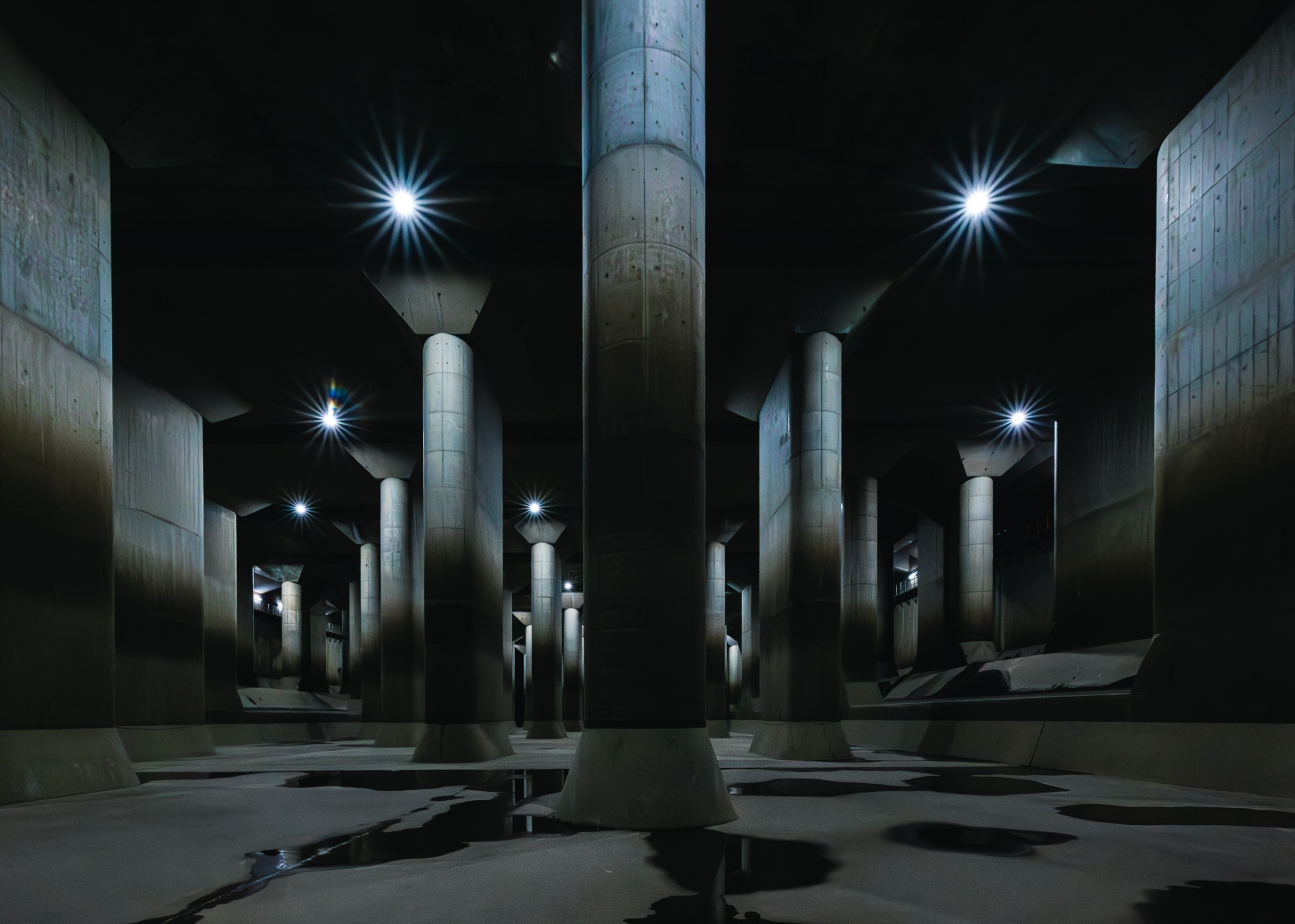
The puddles on the floor were enough to reflect the columns. They were not enough to give the room much to do.
Above them, rows of concrete pillars disappeared into the dimness of a chamber that looked ready for a very substantial deity.
This place was built not for devotion, but for diversion.
Flood diversion, to be precise. This is the Metropolitan Area Outer Underground Discharge Channel—MAOUDC, also known as G-Cans—in Kasukabe, Saitama Prefecture, northeast of Tokyo. Its most photographed chamber is officially the Pressure-Adjusting Water Tank. “Underground Temple” is easier to remember, and considerably closer to what it looks like.
A question of scale
The tank is 177 metres long, with 59 concrete columns arranged in long rows. Each column rises 18 metres. I could understand those measurements, but a person standing beside one made them much harder to dismiss.
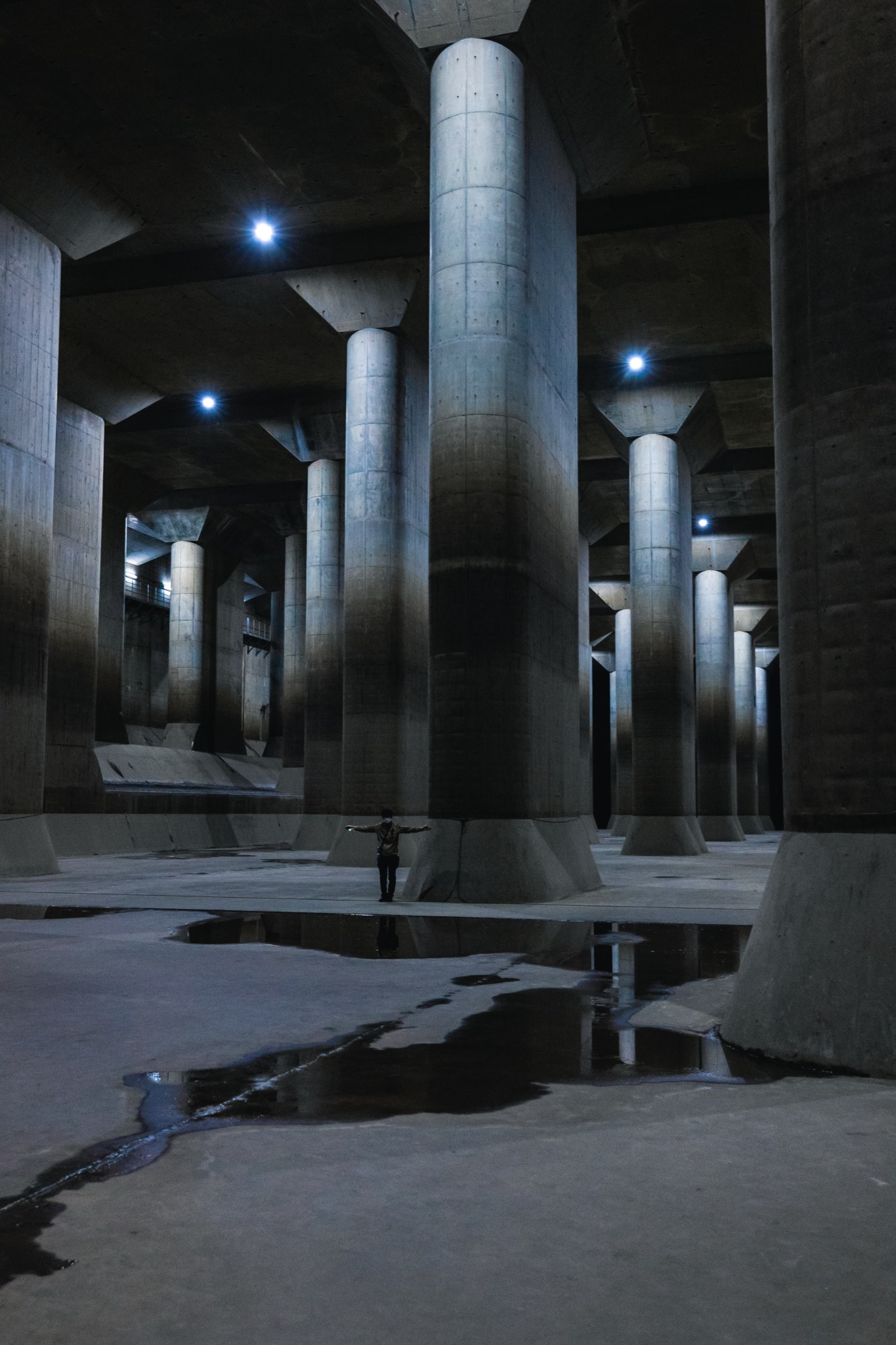
The columns support not just the ceiling but the earth beneath a sports ground above it. There is something pleasing about all this subterranean grandeur helping to keep a playing field flat.
Even keeping the tank underground required some thought. Groundwater exerts upward pressure on the structure, so the engineers made its concrete slabs thicker to provide enough weight to resist it. The solution to floating, it turns out, was more concrete.
All of this exists because of the land around it. The basin of the Naka and Ayase rivers is low and nearly flat, hemmed in by larger rivers including the Arakawa, the Tone and the Edo. Officials compare it to the bottom of a dish. A dish is an excellent shape for holding liquid. That is the problem.
When the basin’s smaller rivers rise, the excess is sent into a 6.3-kilometre tunnel, 50 metres beneath National Route 16, linking five enormous shafts.
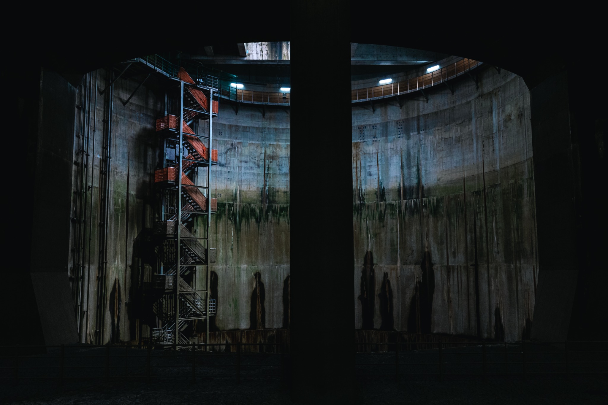
Beyond the columns, a red maintenance staircase offered a glimpse of how far the engineering continued.
The hole next door
I had joined the Shaft Experience Course, which took us onto the maintenance catwalk inside No. 1 Shaft. The chamber had made me look up. Here, the view went in the other direction.
The shaft is roughly 70 metres deep and about 30 metres across. Its staircase zigzagged down the wall, giving the eye something familiar to follow into an increasingly unfamiliar amount of space.
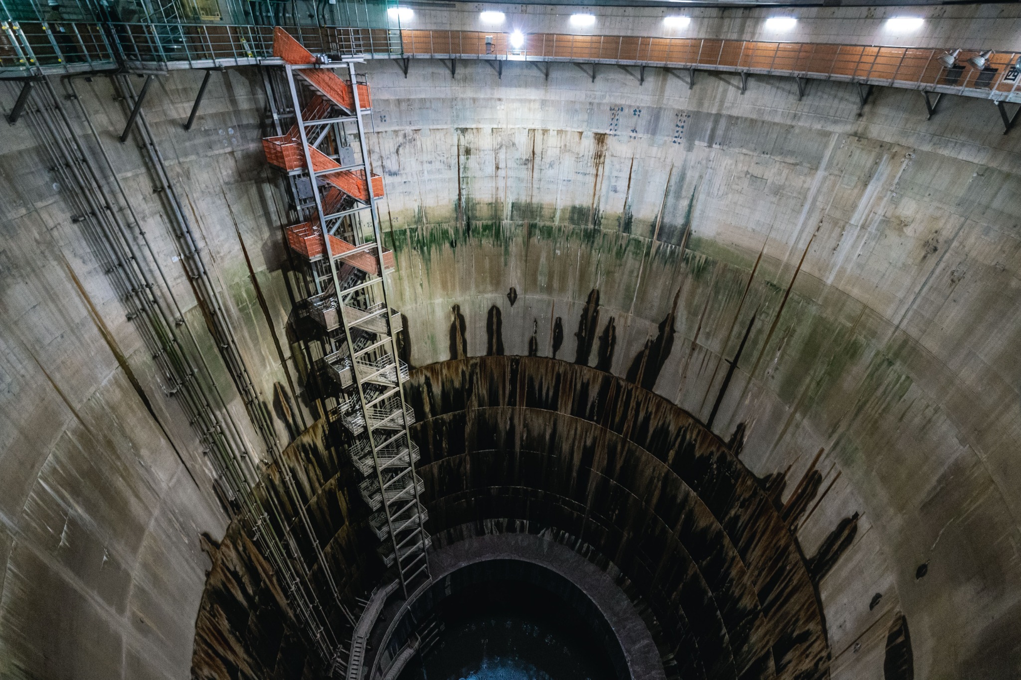
It reminded me of Made in Abyss, the manga and anime set around a vast chasm whose depths become increasingly dangerous to return from. Not the most reassuring association to bring on a guided tour.
The hole drew my gaze downwards while the rest of my body strongly preferred to stay away from the edge. Unfortunately, it was also extremely photogenic.
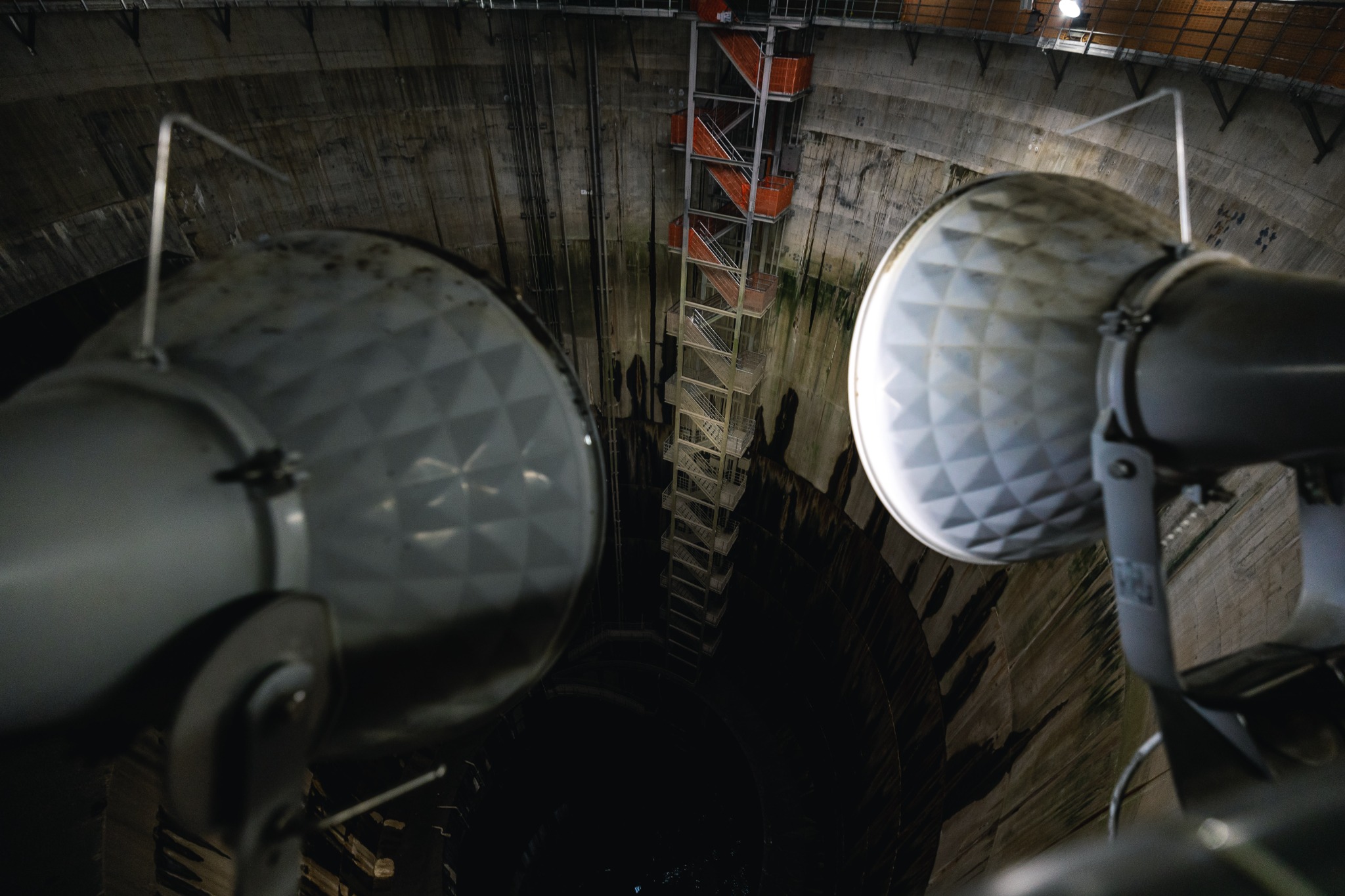
I was attached to a safety harness. My electronics were not. Holding a camera above that drop produced a very specific kind of anxiety. Gravity began to feel personally interested in my possessions.
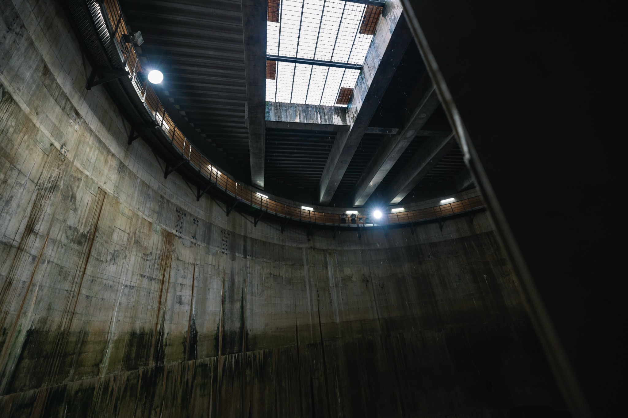
When the water arrives
No. 1 Shaft sends that collected water into the chamber I had just been admiring. There, the water’s momentum is reduced before it reaches the pumps and is eventually discharged into the Edo River.
Those pumps can discharge up to 200 cubic metres per second. The official comparison is a 25-metre school swimming pool every second. Before you have finished picturing the first pool, another has gone.
Their power comes from gas turbines adapted from aircraft technology. The rain does not have to be impressed. It just has to be moved.
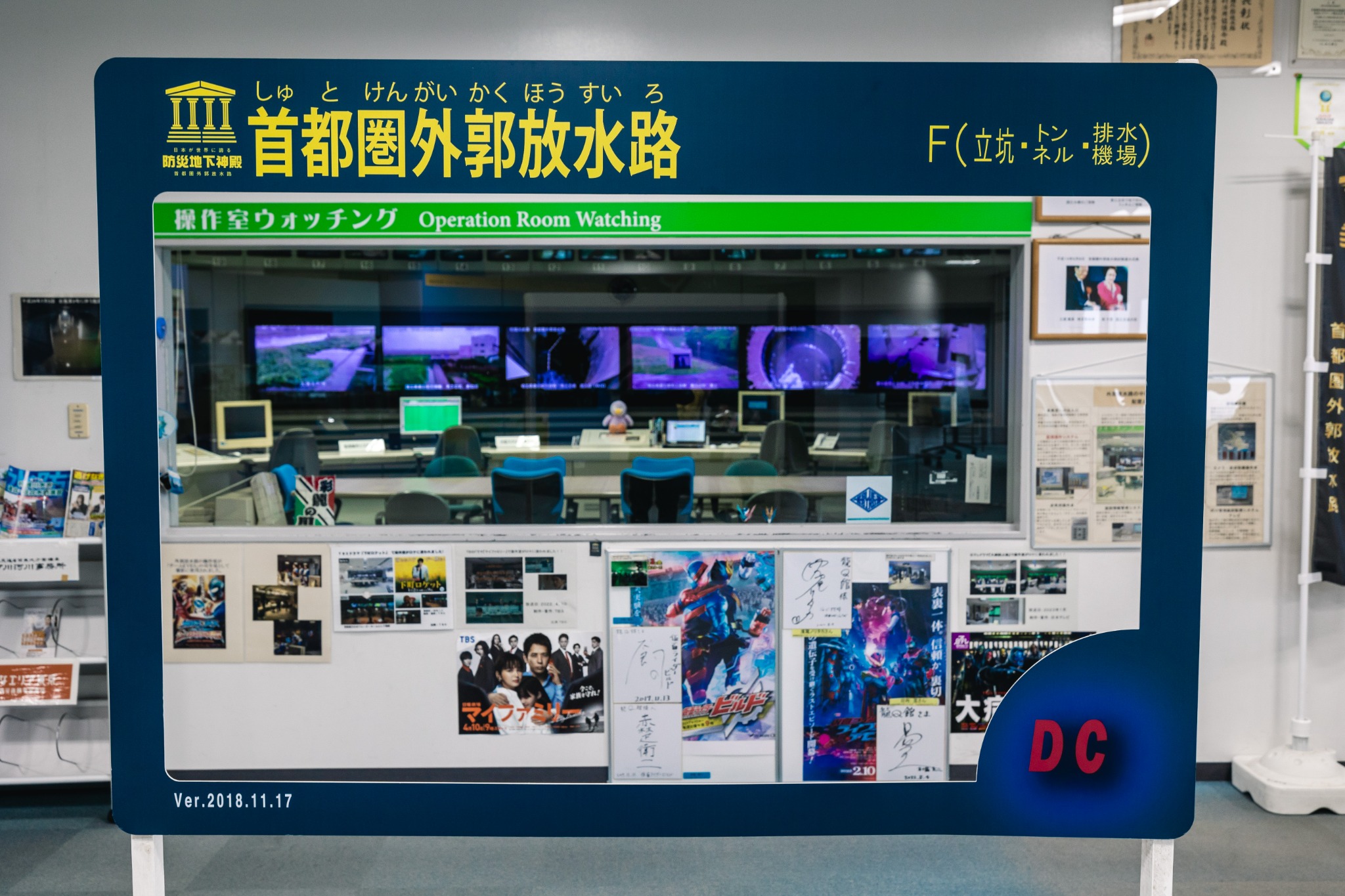
Behind the monitors and desks is the practical work that keeps the system running: gathering weather and river data, opening and closing gates, starting and stopping pumps, and checking on camera that nobody is in harm’s way.
The photographs show a space people can enter, pause in and admire. When heavy rain activates the flood-control system, that arrangement changes. The tank floor closes to visitors, and any viewing that remains possible is from the maintenance walkway above. The room has other work to do.
Its size had made me feel small; understanding what it was for made that size reassuring. All that concrete, depth and machinery was there to help keep rising water out of the homes and streets above.
Noah built an ark for one flood. Beneath Kasukabe, the temple goes to work about seven times a year.
Visit this place
Location
Metropolitan Area Outer Underground Discharge Channel (首都圏外郭放水路)
RyūQkan reception, 720 Kamikanasaki, Kasukabe, Saitama 344-0111, Japan
Practical Information
- Access
- Minami-Sakurai Station (Tobu Urban Park Line)
The facility is not especially easy to reach, and the walk from the station takes about 25–30 minutes. Make sure to allow enough time to arrive before your reserved tour. - Admission
- Guided tour required for the underground facilities
Prices vary by course — check the official tour website for current details. - Reservations
- Book in advance; same-day reservations are not accepted.
- Check-in
- Complete check-in at least 10 minutes before the tour.
- Accessibility
- All courses involve about 100 steps each way, with no lift or escalator. Participants must manage the stairs independently.
- Children
- Preschool children cannot join, even with an adult. Elementary and junior high school students need an adult companion; check the chosen course’s supervision requirements.
- Footwear
- Wear shoes with good grip. Slippery shoes, narrow heels and beach sandals are not permitted.
- Visitor note
- Operations, maintenance or weather can cancel tours or restrict the areas visited.
- Phone
- +81 48-747-0281
- Official tour website
- Tour courses · Booking and participation conditions
Information last checked: September 25, 2026 (booking, participation conditions and contact details).
Note for overseas visitors: On-site explanations and safety instructions are in Japanese. Arrange a companion who can understand them, or contact the operator before booking to confirm language arrangements.
Conversation
Comments
Review pending commentsComments are reviewed before appearing. The internet already contains enough unattended surprises.
Checking comments…
Comments are not available in this migration preview yet. Existing comments remain on the current site.
Leave a comment